
File:Island of Ireland location map Armagh.svg

此 SVG 檔案的 PNG 預覽的大小:781 × 600 像素。 其他解析度:313 × 240 像素 | 625 × 480 像素 | 1,001 × 768 像素 | 1,280 × 983 像素 | 2,560 × 1,965 像素 | 934 × 717 像素。
原始檔案 (SVG 檔案,表面大小:934 × 717 像素,檔案大小:828 KB)
| 描述 |
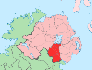
English: The island of Ireland, showing international border between Ireland and Northern Ireland, traditional provinces, traditional counties, and local authority areas in Ireland and Northern Ireland. |
| 日期 | (UTC) |
| 來源 | |
| 作者 |
|
| 這是一張修飾過的圖片,即本圖片是用軟體修改過後的版本,修改的方式或內容有:Added colours for specific county。原版圖片來源:Island of Ireland location map.svg。修改者:Mabuska。
|
我,本作品的著作權持有者,決定用以下授權條款發佈本作品:
此檔案採用創用CC 姓名標示-相同方式分享 3.0 未在地化版本授權條款。
- 您可以自由:
- 分享 – 複製、發佈和傳播本作品
- 重新修改 – 創作演繹作品
- 惟需遵照下列條件:
- 姓名標示 – 您必須指名出正確的製作者,和提供授權條款的連結,以及表示是否有對內容上做出變更。您可以用任何合理的方式來行動,但不得以任何方式表明授權條款是對您許可或是由您所使用。
- 相同方式分享 – 如果您利用本素材進行再混合、轉換或創作,您必須基於如同原先的相同或兼容的條款,來分布您的貢獻成品。
原始上傳日誌
This image is a derivative work of the following images:
- File:Island_of_Ireland_location_map.svg licensed with Cc-by-sa-3.0
- 2010-03-06T20:43:33Z Rannpháirtí anaithnid 1450x1807 (679207 Bytes) Fix incorrectly coloured isands.
- 2010-03-03T22:19:29Z Rannpháirtí anaithnid 1450x1807 (679744 Bytes) {{Information |Description={{de|Positionskarte von [[:de:Irland|Irland]]}} Quadratische Plattkarte, N-S-Streckung 170 %. Geographische Begrenzung der Karte: * N: 55.6° N * S: 51.2° N * W: 11.0° W * O: 5.0° W {{en|Location
Uploaded with derivativeFX
檔案歷史
點選日期/時間以檢視該時間的檔案版本。
| 日期/時間 | 縮圖 | 尺寸 | 使用者 | 備註 | |
|---|---|---|---|---|---|
| 目前 | 2010年7月19日 (一) 12:22 | | 934 × 717(828 KB) | Mabuska | Reverted to version as of 11:54, 19 July 2010 |
| 2010年7月19日 (一) 12:21 |  | 931 × 701(826 KB) | Mabuska | fixing attempt | |
| 2010年7月19日 (一) 12:05 |  | 930 × 700(826 KB) | Mabuska | fixing attempt | |
| 2010年7月19日 (一) 11:58 |  | 934 × 717(830 KB) | Mabuska | boundary fix | |
| 2010年7月19日 (一) 11:54 |  | 934 × 717(828 KB) | Mabuska | {{Information |Description={{en|The island of Ireland, showing international border between Northern Ireland and Republic of Ireland, traditional provinces, traditional counties, and local authority areas in the Republic of Ireland and Northern Ireland.}} |
檔案用途
下列頁面有用到此檔案:
全域檔案使用狀況
以下其他 wiki 使用了這個檔案:
- bg.wikipedia.org 的使用狀況
- cs.wikipedia.org 的使用狀況
- de.wikipedia.org 的使用狀況
- en.wikipedia.org 的使用狀況
- es.wikipedia.org 的使用狀況
- eu.wikipedia.org 的使用狀況
- Armagh
- Portadown
- Newry
- Lankide:Euskaldunaa
- Lurgan
- Craigavon
- Armagh konderria
- Txantiloi:Armagh konderriko udalerriak
- Acton (Armagh konderria)
- Aghacommon
- Annaghmore (Armagh konderria)
- Annahugh
- Ardress (Armagh konderria)
- Aughanduff
- Ballydugan
- Ballymacnab
- Bannfoot
- Belleeks
- Bessbrook
- Blackwatertown
- Broomhill (Armagh konderria)
- Camlough
- Carrickaness
- Charlemont (Armagh konderria)
- Cladymore
- Clonmore (Armagh konderria)
- Collegeland (Armagh konderria)
- Corrinshego
- Creeveroe
- Creggan (Armagh konderria)
- Crossmaglen
- Cullaville
- Cullyhanna
- Darkley
- Derryadd
- Derrycrew
- Derrymacash
- Derryhale
- Derrynoose
- Derrytrasna
- Dorsey (Armagh konderria)
- Drumnacanvy
檢視此檔案的更多全域使用狀況。