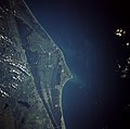
File:Cape canaveral.jpg
外觀

預覽大小:606 × 600 像素。 其他解析度:242 × 240 像素 | 485 × 480 像素 | 776 × 768 像素 | 1,035 × 1,024 像素 | 2,069 × 2,048 像素 | 5,320 × 5,266 像素。
原始檔案 (5,320 × 5,266 像素,檔案大小:7.79 MB,MIME 類型:image/jpeg)
檔案歷史
點選日期/時間以檢視該時間的檔案版本。
| 日期/時間 | 縮圖 | 尺寸 | 用戶 | 備註 | |
|---|---|---|---|---|---|
| 目前 | 2009年3月21日 (六) 19:35 |  | 5,320 × 5,266(7.79 MB) | Jhf | Same image with greater resolution |
| 2005年6月18日 (六) 02:39 |  | 504 × 633(98 KB) | Charlitos~commonswiki | Cape Canaveral, Florida, USA - August 1991 from: http://en.wikipedia.org/wiki/Image:Cape_canaveral.jpg image description [http://eol.jsc.nasa.gov/sseop/EFS/photoinfo.pl?PHOTO=STS043-84-31 here] {{PD-USGov-NASA}} |
檔案用途
下列2個頁面有用到此檔案:
全域檔案使用狀況
以下其他 wiki 使用了這個檔案:
- af.wikipedia.org 的使用狀況
- ang.wikipedia.org 的使用狀況
- ar.wikipedia.org 的使用狀況
- ast.wikipedia.org 的使用狀況
- az.wikipedia.org 的使用狀況
- be.wikipedia.org 的使用狀況
- bg.wikipedia.org 的使用狀況
- bn.wikipedia.org 的使用狀況
- bs.wikipedia.org 的使用狀況
- ca.wikipedia.org 的使用狀況
- ceb.wikipedia.org 的使用狀況
- ckb.wikipedia.org 的使用狀況
- cs.wikipedia.org 的使用狀況
- da.wikipedia.org 的使用狀況
- de.wikipedia.org 的使用狀況
- de.wikinews.org 的使用狀況
- de.wikivoyage.org 的使用狀況
- el.wikipedia.org 的使用狀況
- en.wikipedia.org 的使用狀況
- en.wikiversity.org 的使用狀況
- eo.wikipedia.org 的使用狀況
- es.wikipedia.org 的使用狀況
- et.wikipedia.org 的使用狀況
- eu.wikipedia.org 的使用狀況
- fa.wikipedia.org 的使用狀況
- fi.wikipedia.org 的使用狀況
- fr.wikipedia.org 的使用狀況
- gl.wikipedia.org 的使用狀況
- he.wikipedia.org 的使用狀況
- he.wikivoyage.org 的使用狀況
- hr.wikipedia.org 的使用狀況
- hu.wikipedia.org 的使用狀況
檢視此檔案的更多全域使用狀況。

